Transit

Transit services to OHSU includes TriMet, Portland Streetcar, C-TRAN and Portland Aerial Tram. All public transit is ADA accessible.
TriMet, Streetcar and C-TRAN all use a fare system called Hop. The Tram is not part of the Hop system.
Park and Rides offer free parking at over 60 transit locations. Find a park and ride here.
Explore stops, routes and more by transit agency or OHSU destination below.
Transit agencies
TriMet
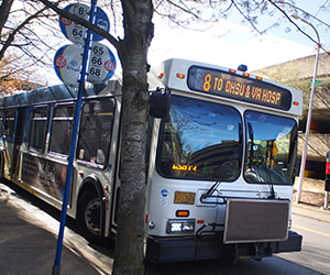
TriMet provides bus, light rail and commuter rail throughout the Portland metro region including Marquam Hill, South Waterfront and OHSU sites throughout Multnomah, Washington and Clackamas counties.
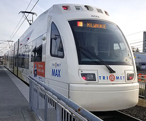
TriMet Fare:
People with an OHSU badge can acquire a Hop card from OHSU at a significant discount by visiting Campus Access and Commute Services.
See OHSU rates for people with an OHSU badge here.
Portland Streetcar
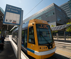
Portland Streetcar provides streetcar service throughout Portland's central east and west sides including South Waterfront and Portland Aerial Tram.
Fare:
An OHSU badge and/or OHSU Hop Card is valid fare on Streetcar.
C-TRAN
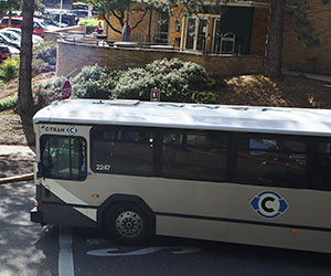
C-TRAN Express bus provides peak hour bus service from Vancouver, WA to the Portland metro region including Marquam Hill. C-TRAN additionally provides local service in the Vancouver, WA metro area.
Fare:
People with an OHSU badge can acquire a C-TRAN Hop card at Campus Access and Commute Services.
Aerial Tram
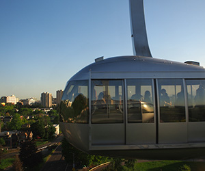
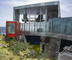
Portland Aerial Tram travels between Marquam Hill and South Waterfront. The South Waterfront terminal is serviced by TriMet bus, light rail and Portland Streetcar. The Marquam Hill terminal is serviced by TriMet and C-TRAN bus.
Visit gobytram.com for hours, closures and more information.
Fare:
An OHSU badge is valid fare on Portland Aerial Tram.
Patients and their visitors may request courtesy tickets from their clinic or any OHSU concierge desk.
See fare options and purchase: gobytram.com/fare
OHSU Destinations
Tram
Marquam Hill is accessible via a five-minute ride onssss the Tram. See South Waterfront transit connections on this page to take transit to South Waterfront and then the Tram to Marquam Hill.
Destinations by building
Select a building from the dropdown list to open a page with: The recommended transit stop, current arrival times, an interactive map and trip planner.
- Marquam Hill buildings
- EMERGENCY (Stop 5028)
- Baird Hall (Stop 5032)
- BICC Library (Stop 5032)
- Building 28 (Stop 10612)
- Campus Services Bldg (Stop 9488)
- Casey Eye Institute (Stop 14093)
- CDRC (Stop 1947)
- Dillehunt Hall (Stop 5032)
- Doernbecher Children's (Stop 10176)
- Dotter Institute (Stop 1947)
- Emma Jones Hall (Stop 5027)
- Energy Management Ctr (Stop 1947)
- Elks Children's Eye Clinic (Stop 14093)
- Gaines Hall (Stop 1949)
- Hatfield Research Ctr (Stop 5032)
- Kohler Pavilion (Stop 5028)
- Lamfrom BRB (Stop 5032)
- Mackenzie Hall (Stop 5032)
- Medical Research Bldg (Stop 5032)
- Modular Office Bldg (Stop 10176)
- Multnomah Pavilion (Stop 5028)
- OHSU Auditorium (Stop 5032)
- OHSU Hospital (Stop 5028)
- OHSU Student Center (Stop 10176)
- Physical Plant (Stop 5032)
- Physicians Pavilion (Stop 5028)
- Richard T. Jones Hall (Stop 5032)
- Sam Jackson Hall (Stop 5032)
- School of Nursing (Stop 9488)
- Shriner's Hospital (Stop 5027)
- VA Medical Center (Stop 5975)
- Vollum Institute (Stop 5032)
Tram
The South Waterfront Campus is accessible via a five-minute ride by tram. See Marquam Hill transit connections on this page to take transit to Marquam Hill and then the Tram to South Waterfront.
Routes to South Waterfront
Take TriMet and Streetcar lines to South Waterfront:
Portland Streetcar (all lines)
Additional transit lines are accessible via the Hooley Pedestrian Bridge at Gibbs Street. The bridge connects from S.W. Gibbs and Kelly in the Lair Hill Neighborhood to S.W. Moody and Gibbs at the Tram. Hooley Bridge in Google Maps.
The following TriMet lines are walkable from the Gibbs and Tilikum bridges:
Destinations by building
Select a building from the dropdown list to open a page with: The recommended transit stop, current arrival times, an interactive map and trip planner.
- South Waterfront buildings
- 3030 Moody (Stop 13728)
- Bike Plaza (Stop 12760)
- Center for Health and Healing (Stop 12760)
- Healthy Starts Children's Center (Stop 12760)
- Knight Cancer Research Building (Stop 13728)
- Macadam Warehouse (Stop 13183)
- Portland Aerial Tram Lower Terminal (Stop 12845)
- RiverPlace Marina Parking Lot (Stop 12379)
- Robertson Life Sciences Building (Stop 13728)
- Rood Family Pavilion (Stop 12760)
- School of Dentistry (Skourtes Tower) (Stop 13602)
- Schnitzer Parking Lot (Stop 13602)
TriMet's Willow Creek Station is 0.5 mile south of West Campus or about a ten minute walk.
Willow Creek Station stop information
Willow Creek is served by the following TriMet lines:
OHSU has over a dozen neighborhood locations around the region accessible by transit. Use TriMet's full system map or, for destinations outside the TriMet system, plan a transit trip with Google Maps.