About Rural and Frontier Data

Oregon Office of Rural Health Geographic Definitions
Rural as any geographic areas in Oregon ten or more miles from the centroid of a population center of 40,000 people or more.
Frontier as any county with six or fewer people per square mile. ORH has identified 10 of Oregon’s 36 counties as frontier. More information can be found at the bottom of this page.
ORH uses population numbers from the Population Research Center at Portland State University for incorporated cities and counties, and numbers from Claritas for Oregon Zip Codes.
Using 2024 Claritas data, 33% (1,403,688) of Oregon’s population lives in rural areas, 2% (97,666) in frontier, and 65% (2,772,488) in urban areas.
-
- Spreadsheet of Oregon Zip Codes, Towns, Cities and Service Areas and their ORH Urban/Rural/Frontier Designation (4/15/2026)
- Map of ORH Urban/Rural/Frontier Designation Areas (static image | dynamic map)
Oregon's Frontier Counties
- Baker
- Gilliam
- Grant
- Harney
- Lake
- Malheur
- Morrow
- Sherman
- Wallowa
- Wheeler
Other Recognized Definitions of Rural and Frontier
-
What is Rural
All population and territory that is NOT an Urban Area.
Definitions
Areas that contain at least 2,000 housing units or have a population of at least 5,000.
Update Status
ZIP Code and Census tract versions based on 2020 Census, updated September 2025.
Health Policy Use
Clinics located outside of 2010 Urbanized Areas or 2020 Urban Areas are geographically eligible for Rural Health Clinic (RHC) designation. Check geographic eligibility here.
For more information, visit the Census Bureau on urban and rural classification. -
What is Rural
All counties that are NOT a Metropolitan Statistical Area (MSA)
Definitions
- Metropolitan Statistical Area (MSA)
- A Core Based Statistical Area associated with at least one Urban Area that has a population of at least 50,000. The MSA comprises the central county or counties containing the core, plus adjacent outlying counties having a high degree of social and economic integration with the central county or counties as measured through commuting.
- Micropolitan Statistical Areas
- A Core Based Statistical Area associated with at least one Urban Area that has a population of at least 10,000, but less than 50,000. The Micropolitan Statistical Area comprises the central county or counties containing the core, plus adjacent outlying counties having a high degree of social and economic integration with the central county or counties as measured through commuting.
Update Status
- Population numbers from 2020 Census
- Updated every few years
Health Policy Use
Used to categorize hospitals as either rural or urban for purposes of Medicare reimbursement.
For more information, please visit the Census Bureau. - Metropolitan Statistical Area (MSA)
-
What is Rural
ZIP Codes or Census Tracts that are categorized 4 to 10.
Definitions
- Metropolitan core: primary flow is within an urban area of 50,000 or more people (metro UA)
- Metropolitan high commuting: primary flow is 30 percent or more to a metro UA
- Metropolitan low commuting: primary flow is 10 percent to 30 percent to a metro UA
- Micropolitan core: primary flow is within an urban area of 10,000 to 49,999 people (micro UA)
- Micropolitan high commuting: primary flow is 30 percent or more to a micro UA
- Micropolitan low commuting: primary flow is 10 percent to 30 percent to a micro UA
- Small town core: primary flow is within an urban area of 9,999 or fewer people (small town UA)
- Small town high commuting: primary flow is 30 percent or more to a small town UA
- Small town low commuting: primary flow is 10 percent to 30 percent to a small town UA
- Rural area: primary flow is to a tract outside an UA
UA = urban area; primary flow = largest commuting flow from a census tract
Source: USDA, Economic Research ServiceUpdate Status
- ZIP Code and Census Tract versions based on 2020 Census, updated July 2025
Health Policy Use
Areas categorized 4-10 are eligible for grants issued by FORHP (Federal Office of Rural Health Policy).
For more information, visit USDA Economic Research Service (ERS). -
What is Frontier
The United States Department of Agriculture (USDA) Economic Research Service (ERS) developed four levels of ZIP-code-level frontier and remote area (FAR) codes ranging from one that is relatively inclusive (12.8 million FAR level one residents—3.9% of the 2020 US population) to one that is more restrictive (3.6 million FAR level four residents—1.1% of the 2020 population).
Definitions
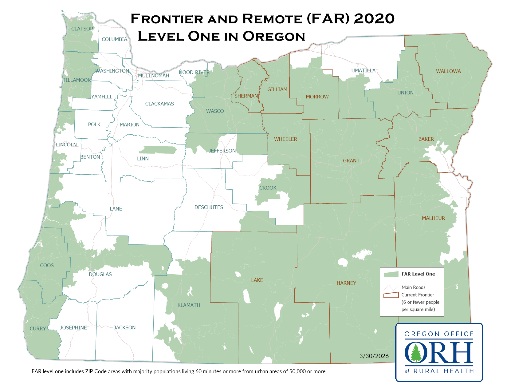
FAR level one: ZIP code areas with majority populations living 60 minutes or more from urban areas of 50,000 or more.
FAR level one map
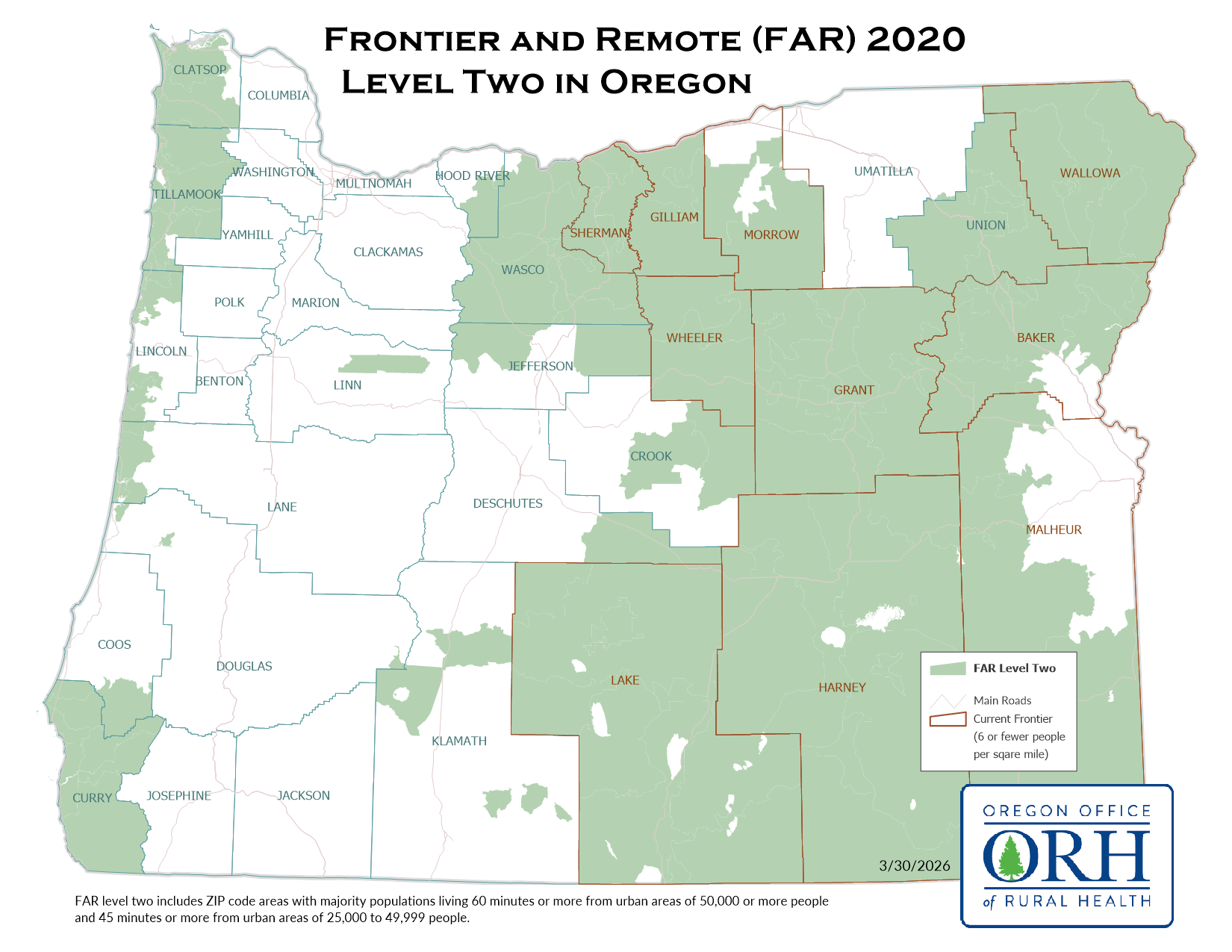
FAR level two: ZIP code areas with majority populations living 60 minutes or more from urban areas of 50,000 or more people and 45 minutes or more from urban areas of 25,000-49,999 people.FAR level two map
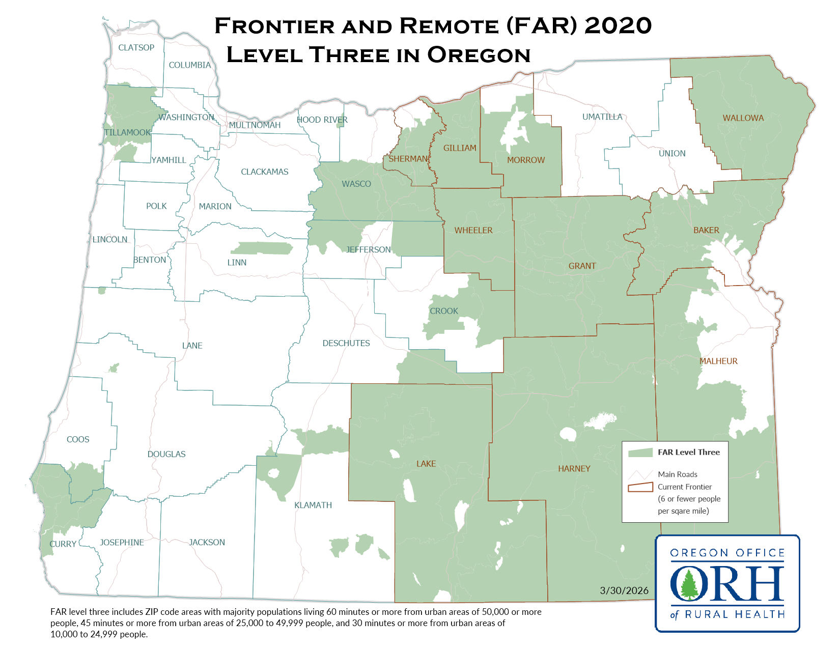
FAR level three: ZIP code areas with majority populations living 60 minutes or more from urban areas of 50,000 or more people; and 45 minutes or more from urban areas of 25,000-49,999 people; and 30 minutes or more from urban areas of 10,000- 24,999 people.FAR level three map
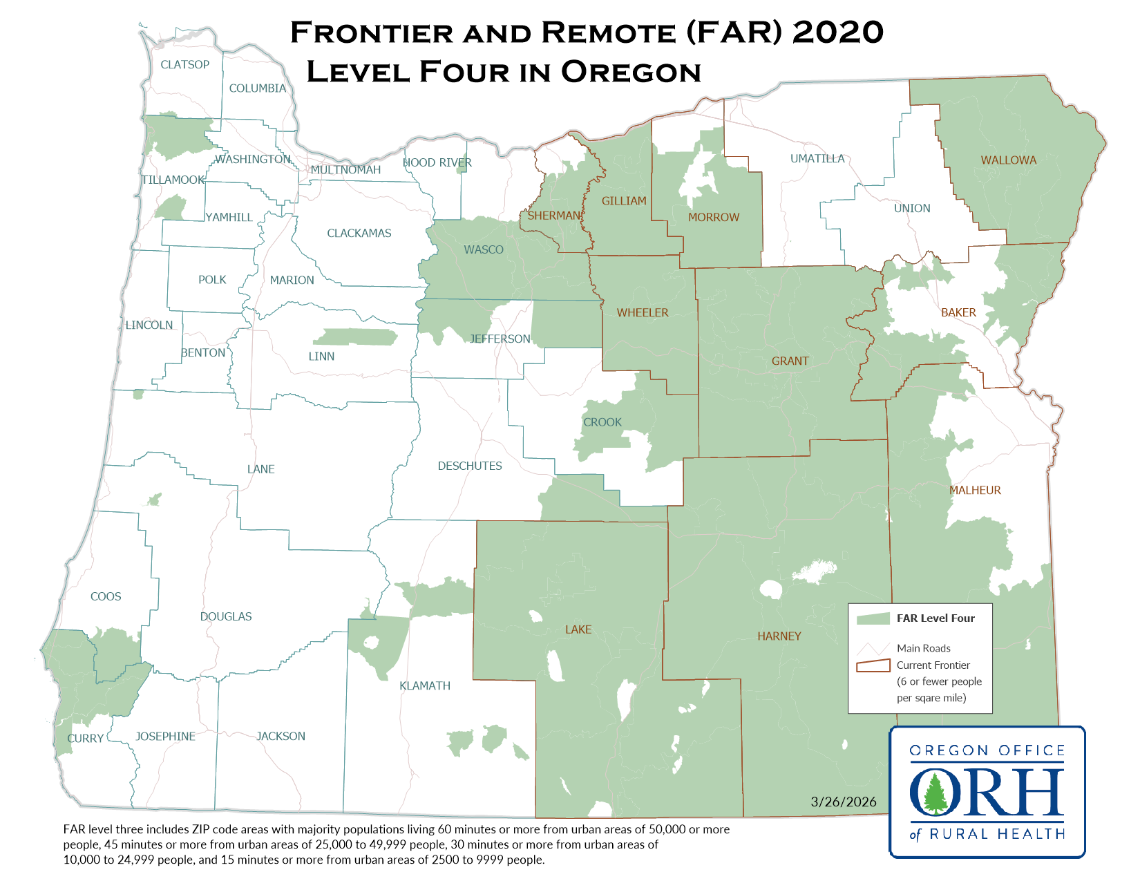
FAR level four: ZIP code areas with majority populations living 60 minutes or more from urban areas of 50,000 or more people; and 45 minutes or more from urban areas of 25,000-49,999 people; and 30 minutes or more from urban areas of 10,000- 24,999 people; and 15 minutes or more from urban areas of 2,500-9,999 people.Update Status
- ZIP Code version based on 2020 Census
- Updated decennially
Health Policy Use
Currently none.
For more information, visit the USDA ERS website.
Download a table on how these different definitions affect healthcare policy.
Use the Am I Rural Tool to search for rural definitions for your community.
Use the Rural Health Grants Eligibility Analyzer to check for rural grant eligibility.
Contact
Emerson Ong | 503-494-5526